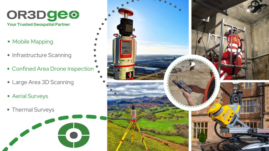
OR3D’s Geospatial Services: A closer look at the specific technologies and services OR3D GEO offer and the industries we serve.
The geospatial industry is undergoing a remarkable transformation, driven by technological advancements that have redefined how we collect, analyse, and visualise spatial data. In this blog post, we'll embark on a journey through the exciting world of geospatial technology, with a focus on OR3D GEO’s key services with the use of drones, mobile mapping, thermal imaging, and survey solutions. These cutting-edge tools are reshaping industries, improving efficiency, and helping us make better-informed decisions about our environment, workplace and structures.
Drone Surveys
Drone surveys offer several advantages in civil infrastructure surveying. Drone technologies eliminate the need for personnel to access hard-to-reach areas, such as bridges, power lines or tall buildings. This enhances worker safety and drastically reduces operational costs. All this leads to rapid data collection, enabling quicker decision making and reducing project timelines.
Construction and Infrastructure: Construction companies leverage drones for site surveys, progress monitoring, and safety inspections, saving time and resources.
Environmental Conservation: Conservationists employ drones to track wildlife, monitor ecosystems, and combat illegal activities like poaching, contributing to the protection of our planet’s biodiversity.
Agriculture: Drones are being used for precision agriculture, enabling farmers to monitor crop health, optimise irrigation, and reduce chemical usage, ultimately increasing yields and sustainability.
Mobile Mapping
Mobile mapping systems have transformed vehicles into powerful data collection platforms. Equipped with a combination of GPS, LiDAR, cameras, and other sensors, they capture highly accurate 3D data as they traverse our roads and landscapes. Here’s how they are making an impact:
Urban Planning: Mobile mapping is crucial for creating precise urban models, optimising traffic flow, and supporting the development of smart cities.
Infrastructure Management: Utility companies use mobile mapping for inventory and assess infrastructure assets, enabling better maintenance and resource allocation.
Transportation Engineering: Mobile mapping aids in the design and optimisation of transportation networks, reducing congestion and improving safety.
Thermal Imaging
Thermal imaging technology extends our vision by detecting heat emissions. It produces images that highlight temperature variations, which can be invaluable in various sectors:
Building and Infrastructure Inspections: Infrared thermal cameras help identify energy inefficiencies, locate water leaks, and detect faulty electrical connections in buildings and infrastructure.
Search and Rescue: First responders use thermal imaging to locate missing persons in challenging conditions, such as during natural disasters or wilderness search operations.
Industrial Applications: Thermal imaging is used for predictive maintenance in industries like manufacturing, helping prevent costly equipment failures.
Large Area 3D Survey: Precision, Efficiency, and Data-Driven Decisions
Large area 3D survey is a cutting-edge geospatial technique that allows for comprehensive assessments of extensive spaces and structures in three dimensions. This technology provides unparalleled precision, efficiency, and data accuracy, making it an essential tool across various industries.
How Large Area 3D Inspection Works:
Large area 3D surveying typically employs a range of sensors. These can include Laser based sensors such as LiDAR (Light Detection and Ranging) technology, photogrammetry and other advanced sensors to capture data over extensive areas:
- LiDAR Scanning: LiDAR sensors emit laser pulses and measure the time it takes for them to bounce back. This data is used to create highly accurate 3D point clouds of the surroundings.
- High-Resolution Imaging: In addition to LiDAR, high-resolution cameras capture detailed imagery, providing texture and context to the 3D data.
- Data Analysis: After data capture, advanced software processes and analyses the information to create comprehensive 3D models and detect anomalies or structural issues.
- Multispectral Sensors: Multispectral sensors capture information in several spectral bands, typically ranging from ultraviolet (UV) to near-infrared (NIR) and sometimes even into the thermal infrared region. Each spectral band corresponds to a specific range of wavelengths.
Applications Across Industries:
Large area 3D inspection has a broad range of applications:
- Construction and Infrastructure: It’s used to monitor construction progress, assess structural integrity, and detect defects in large buildings, bridges, and highways.
- Urban Planning: City planners employ large area 3D inspection to create accurate 3D models of urban environments, facilitating zoning, transportation planning, and disaster preparedness.
- Environmental Monitoring: It helps track changes in landscapes, such as deforestation, erosion, or the impact of natural disasters, supporting conservation and mitigation efforts.
- Industrial Facilities: Manufacturing and industrial plants use it for facility layout planning, maintenance, and safety assessments.
- Transportation Engineering: Transportation engineers utilise large area 3D inspection for road and railway design, ensuring optimal grading and drainage.
- Mining and Natural Resources: It’s applied in mining exploration, resource management, and safety assessments in extractive industries.
- Cultural Heritage Preservation: It aids in documenting and preserving historical sites, buildings, and cultural landscapes.
The Value of Comprehensive 3D Inspection:
Large area 3D inspection provides accurate, detailed, and up-to-date information, enabling data-driven decisions, predictive maintenance, and resource optimisation. Its applications are wide-ranging, and its benefits include:
Early detection of structural issues or anomalies.
Improved safety by reducing the need for manual inspections in hazardous environments.
Cost-effective and efficient data capture over large areas.
Detailed documentation for historical records and trend analysis.
Enhanced infrastructure planning and asset management.
Large area 3D inspection is transforming industries by offering an unprecedented level of precision and insight into the physical world, enabling more informed and efficient decision-making. It is a crucial tool for managing assets, ensuring safety, and maintaining the integrity of critical infrastructure.
Survey Solutions
Survey Solutions provide the foundational data necessary for geospatial projects. They offer precise coordinates and measurements, ensuring accuracy in mapping, construction, and infrastructure development. Their vital roles consist of:
Land Surveying: Survey Solutions define property boundaries, produce topographic maps, and support land development projects, safeguarding property rights and land use planning.
Mining and Resource Management: The mining industry relies on surveying for stockpile management, safety assessments, and optimising resource extraction.
Civil Engineering: Surveying is essential for designing and building infrastructure projects such as roads, bridges, pipelines, and railways, ensuring their safety and functionality.
Geospatial technology is at the forefront of innovation across multiple industries. OR3D GEO’s services helps companies to make more informed decisions, improve efficiency, and drive sustainable practices.
Stay tuned for more insights and discoveries of geospatial innovation with OR3D.