OR3D conducted a high-resolution LiDAR survey for a proposed small-scale hydroelectric site, capturing detailed terrain and flood modelling data to support feasibility assessments.
DownloadOR3D GEO was engaged to support a feasibility study for a proposed small-scale hydroelectric power facility in the UK. The project required rapid, high-resolution terrain data and detailed flood simulation to identify the most suitable location for a new dam. By combining drone-based LiDAR surveying, advanced terrain modelling, and simulation tools, OR3D delivered a fast, accurate, and visually compelling assessment to support informed decision-making and stakeholder engagement.
Client – Hydropower Developer
Services Provided – Drone Based LiDAR Survey, Digital Terrain Model (DTM) Flood Simulation Consulting
Equipment Used – YellowScan Ultra 3, Flood Modeller and Geomagic Design X
A renewable energy developer needed to assess the feasibility of constructing a small-scale hydroelectric power facility in a rural, undeveloped area. The site in question was remote, uneven, and densely vegetated – presenting significant logistical and technical challenges for conventional surveying methods.
The primary goal was to identify a suitable location for a new dam that could provide sufficient water storage capacity. To do so, it was essential to gain a precise understanding of the site’s topography and how water would behave across various seasonal and rainfall scenarios. Speed was also critical, as the findings would inform early-stage planning and support timely funding and stakeholder discussions.
To move the project forward, the client required:
The challenge was not only technical but also logistical: to collect and process large volumes of geospatial data efficiently, simulate realistic flood scenarios, and produce compelling visuals – all within a tight timeframe and with minimal disruption to the natural environment.
Rapid LiDAR Capture
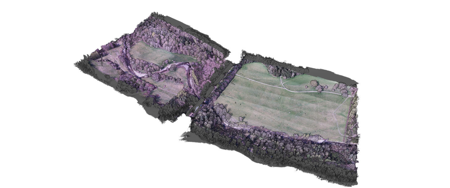
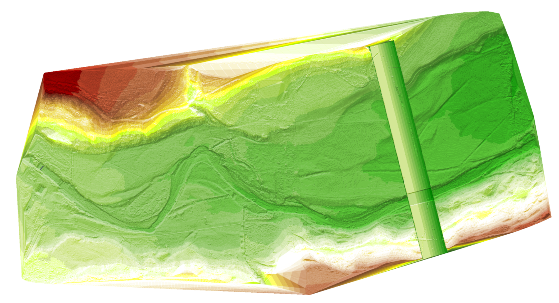
A YellowScan Ultra 3 LiDAR scanner mounted on a drone was used to capture the full site in just over 9o minutes of flight time. This approach significantly reduced time on site while producing rich, high-density spatial data suitable for detailed analysis.
Terrain Data Processing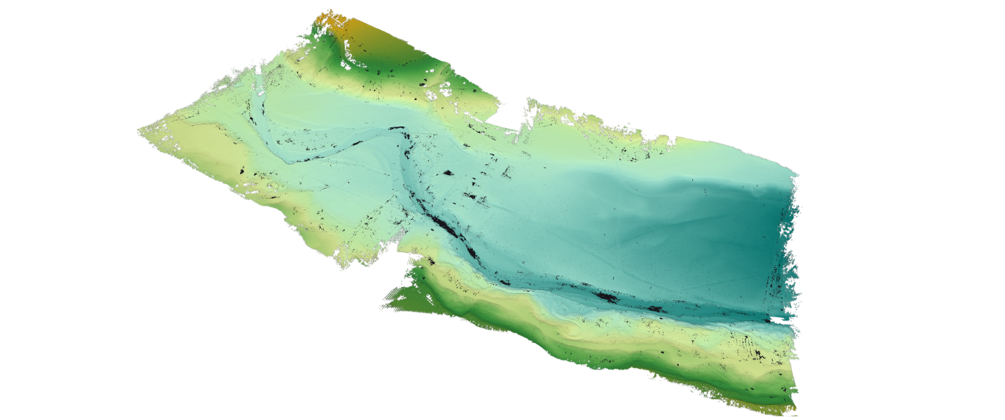
Once collected, the LiDAR data was registered and colourised into a single, unified point cloud. Vegetation was carefully filtered out to produce a clean and accurate Digital Terrain Model (DTM), forming the foundation for the next stages of analysis.
 Flood Simulation
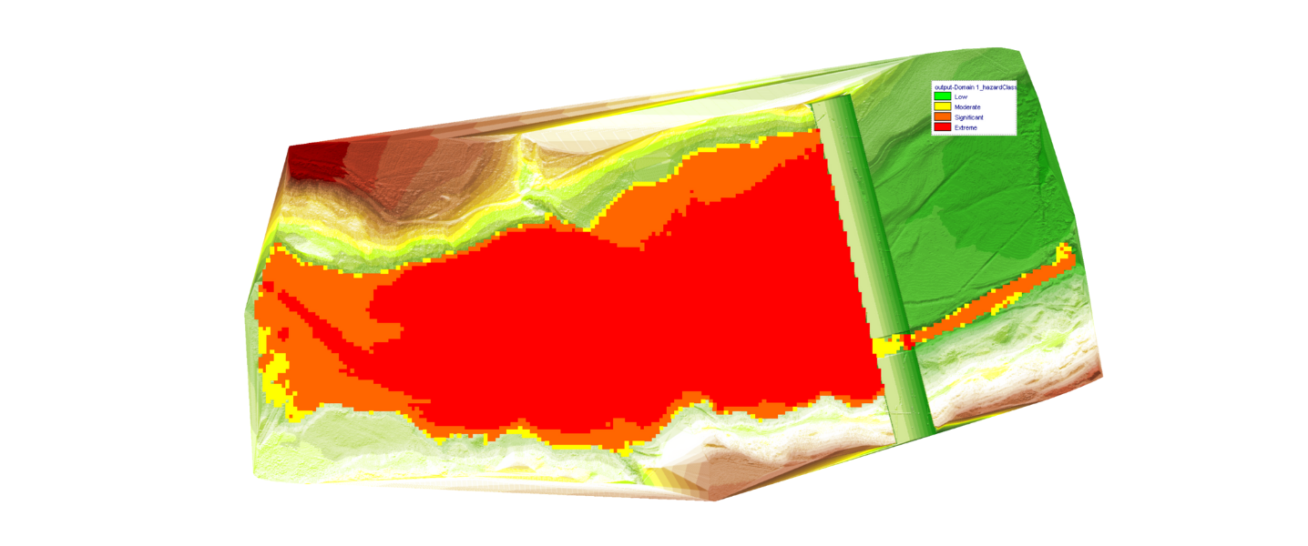
The DTM was imported into Flood Modeller, where a series of simulations were run to assess how water would behave under different flow conditions. This helped determine the most suitable location for the dam, ensuring it would offer sufficient storage capacity while aligning with the site’s natural topography.
3D Modelling and Design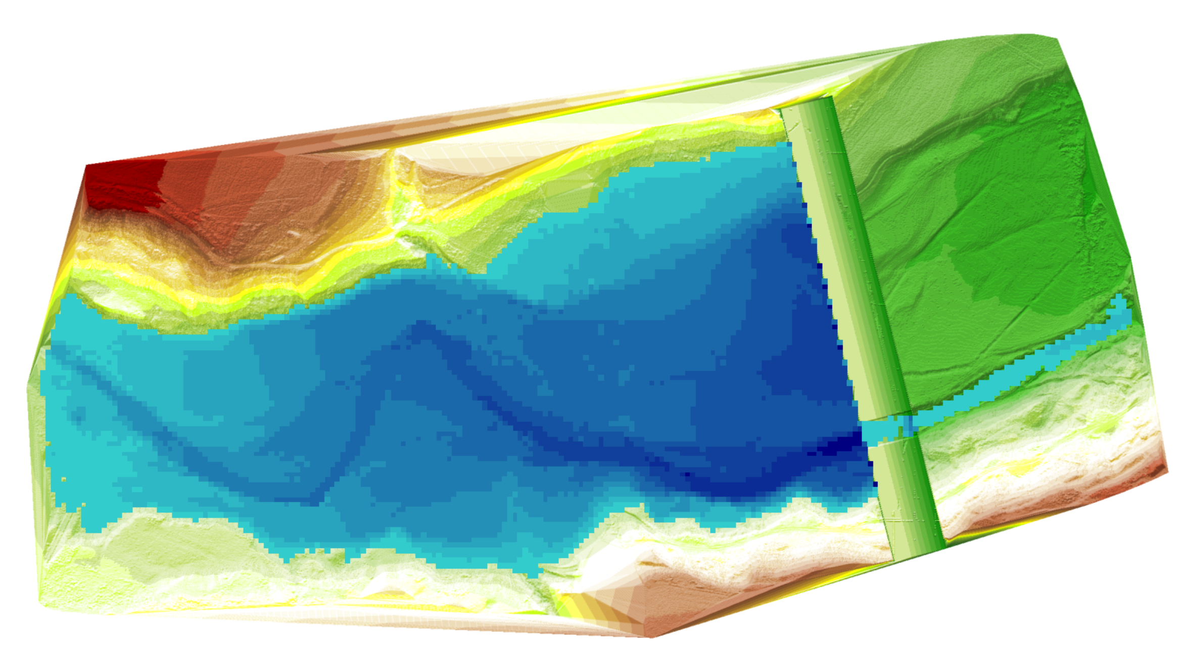
Following the simulation, the selected dam location was further developed in Geomagic Design X. Here, a more detailed model of the dam was created, including the addition of key infrastructure such as a spillway. The enhanced model was then re-integrated into Flood Modeller for final visualisation.
 Visualisation
To support wider engagement, a visual animation was produced to demonstrate how the resevoir would fill and how the spillway would function under real-world conditions. This provided the client with a compelling tool to communicate the proposed development to stakeholders, planners and investors.
OR3D GEO’s integrated use of drone-based LiDAR, digital modelling and flood simulation provided the client with fast, accurate and actionable insights. The project demonstrated the value of combining advanced geospatial technology with an efficient end-to-end workflow.
Key outcomes included:
Through a fully integrated approach combining drone-based LiDAR capture, advanced terrain modelling and flood simulation, OR3D GEO delivered a fast, accurate and insightful feasibility assessment for a proposed small-scale hydro power facility. The seamless workflow enabled confident decision-making, supported effective stakeholder engagement and provided a clear path forward for infrastructure planning – all completed with minimal time on site and maximum technical precision.
Speak to us today on
+44 (0) 1691 777 774

3 Cedar Court, Brynkinalt Business Centre, Chirk, Wrexham, LL14 5NS
Find Us