See your stockpiles clearly – safe, accurate, audit-ready.
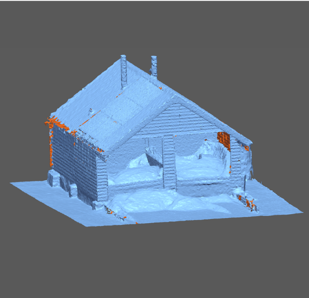
Download Information SheetStockpile measurement is the process of accurately calculating the volume and tonnage of bulk materials such as aggregates, minerals, biomass, waste and recyclables. As part of our stockpile monitoring service, OR3D GEO uses drone and LiDAR capture to create detailed 3D models and turn them into reliable inventory information you can trust. This approach supports consistent stockpile volume calculation across sites, helping you plan operations with confidence.
Traditional walkover surveys and manual measurements can be slow, labour-intensive and often expose teams to unnecessary risk when working at height or on unstable surfaces. By contrast, drone stockpile monitoring and LiDAR surveys are carried out remotely, reducing time on site while improving safety and minimising disruption to day-to-day operations. This type of drone surveying for stockpiles also improves repeatability, so your results are consistent month-to-month and site-to-site.
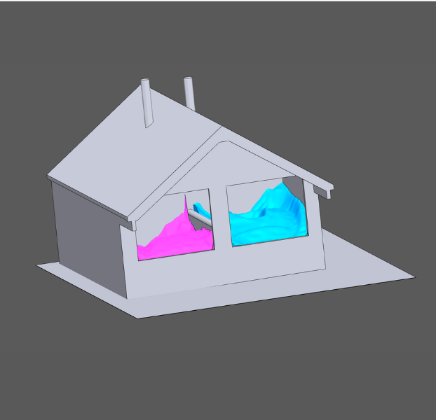
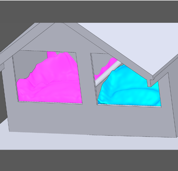
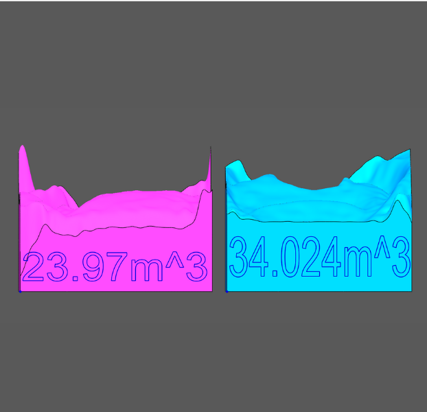
Our survey-grade workflows generate high-resolution 3D models that support volumetric stockpile analysis and dependable reconciliation. From these surfaces, we perform stockpile volume calculation, apply bulk densities for bulk material measurement, and produce clear, traceable reporting for internal management, customers and auditors. Whether you need a one-off year-end stockpile measurement or ongoing stockpile monitoring across multiple sites, the result is more reliable inventory control.
For aggregates and minerals, aggregate stockpile measurement is critical for managing inventory value and operational planning. Our quarry stockpile monitoring service provides repeatable surveys that help reduce write-offs and support reconciliation of movements between periods. Where material is stored across active earthworks and laydown areas, a construction stockpile survey gives you consistent reporting and site volume monitoring without slowing the project down.
With accurate, repeatable data from drone stockpile monitoring, you can reconcile movements, improve auditing confidence and make better operational decisions. Regular site volume monitoring supports trend analysis, while volumetric stockpile analysis helps identify shrinkage, compaction, and unexpected variances. Ultimately, this is bulk material measurement you can defend – internally and externally.
If you manage aggregates, we can schedule recurring aggregate stockpile measurement to support monthly or quarterly reporting. For extractive sites, quarry stockpile monitoring creates consistent datasets for operational planning and compliance. And for infrastructure and civils, a construction stockpile survey provides quick, safe capture with the clarity you need for commercial and progress reporting – all backed by consistent stockpile measurement and auditable stockpile volume calculation.
Speak to us today on
+44 (0) 1691 777 774

3 Cedar Court, Brynkinalt Business Centre, Chirk, Wrexham, LL14 5NS
Find Us