PIX4Dcloud

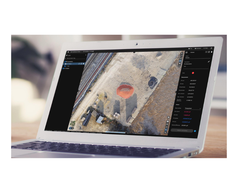
The online platform for ground and drone mapping, progress tracking, and site documentation

Professional photogrammetry on the cloud

Easy to use

Start your new project in minutes. User-friendly platform with no previous training required.

Straightforward Communication

Share your project status with team and stakeholders with the click of a button.

Up-to-date documentation

Keep a permanent and up-to-date record of the project and resolve disputes efficiently.

Professional photogrammetry on the cloud

target-icon-svg

Easy to use

Start your new project in minutes. User-friendly platform with no previous training required.

Straightforward communication

Share your project status with team and stakeholders with the click of a button.

target-icon-svg

Up-to-date documentation

Keep a permanent and up-to-date record of the project and resolve disputes efficiently.

Compare in 2D/3D over time

Compare two specific days to spot what has changed. Overlay your dxf, pdf or ifc file on one side and your orthomosaic/3D point cloud/mesh on the other to get better visualisation of your progress.

Contact OR3D, UK partner to PIX4D for more information.

Contact Us

You may also be interested in

Knowledge Base

OR3D's comprehensive Knowledge Base Blog, your go-to resource for all things related to 3D Printing, Scanning, CAD Modelling, Reverse Engineering, Robotics, and company announcements. Our knowledge base is designed to empower you with the latest industry insights and news.

Get in touch

What happens next?
  • Our expert team will review your enquiry and get back to you by phone or email within two hours.
  • We can answer any queries you may have, assist you in choosing the most appropriate product or get back to you with a quote for your upcoming project. We’re here to help.

Speak to us today on
+44 (0) 1691 777 774

3 Cedar Court, Brynkinalt Business Centre, Chirk, Wrexham, LL14 5NS
Find Us