Powerful photogrammetry software by PIX4D
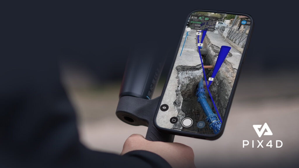
The PIX4Dcatch mobile app with integrated Reach RX allows you to capture precise data using your smartphone camera.
High-Precision 3D Scanning Kit – Accurate Models in Minutes
Achieve centimetre-level accuracy with NTRIP using Reach RX, Emlid’s compact and powerful GNSS solution. Compatible with any correction network or GNSS base station broadcasting RTCM3, it delivers a fix in under 5 seconds – even in challenging environments.
Rugged and Waterproof
Rated IP68, Reach RX is fully protected against dust and can be submerged in water up to 1.5 meters. The connector is sealed with a durable silicone plug, ensuring reliability in all weather conditions.
All-Day Battery Life
Enjoy up to 16 hours of operation on a single charge. Fully recharges in under 3 hours and supports charging via any USB port or power bank – perfect for fieldwork.
Versatile and Portable
Use Reach RX as a standalone rover. Simply detach it from the handle, mount it on a survey pole, and collect or stake out data just like with a traditional GNSS receiver – no base station required.
1. Capture Accurate Data
Use the PIX4Dcatch mobile app with integrated Reach RX to capture high-precision, geotagged data directly from your smartphone camera and LiDAR sensor.
2. Seamless Processing
Automatically upload images to PIX4Dcloud for fast, cloud-based processing, or transfer them to PIX4Dmatic on your desktop using the PIX4Dcatch processing template. Easily merge terrestrial and drone imagery when needed.
3. Export to GIS, CAD, or BIM
Mark and extract features in PIX4Dsurvey as vectors within the point cloud. Export your data in DXF format for CAD or SHP for GIS workflows—ready for integration into your preferred platforms.
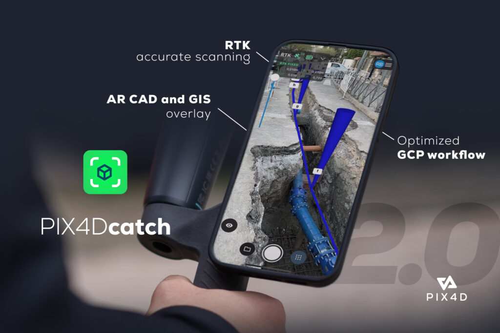
The PIX4Dcatch mobile app with integrated Reach RX allows you to capture precise data using your smartphone camera.
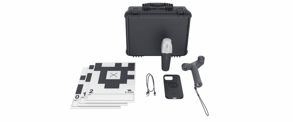
Reach RX and accessories include Reach RX, EMLID scanning handle, Tags (5 pcs), Type-C cable, Leash, Allen key 3 mm and Carrying case.

Reach RX works with any correction network or GNSS base that broadcasts RTCM3.
Mark your assets on PIX4Dsurvey as vectors in the point cloud and export them as DXF or SHP.
OR3D's comprehensive Knowledge Base Blog, your go-to resource for all things related to 3D Printing, Scanning, CAD Modelling, Reverse Engineering, Robotics, and company announcements. Our knowledge base is designed to empower you with the latest industry insights and news.
Speak to us today on
+44 (0) 1691 777 774

3 Cedar Court, Brynkinalt Business Centre, Chirk, Wrexham, LL14 5NS
Find Us