Full-day comfort
Ergonomic backpack system distributes weight for extended field capture. Hot-swap batteries keep you working.
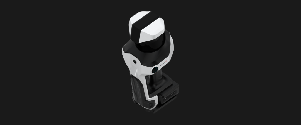
Professional backpack LiDAR - long-range, high-density capture for large sites and urban survey.
The SHARE C10 is a backpack-mounted professional 3D LiDAR scanner built for the largest jobs on the surveyor’s schedule. Long-range capture, high point density, and multi-camera colourisation — engineered for urban renewal projects, tall-building capture, corridor surveys, and any site where a handheld scanner runs out of reach.
Available in three configurations — C10-16, C10-32, and C10-32 PRO – the range scales from 320,000 points per second up to 640,000 points per second, and from 120 m range up to 300 m. Every configuration includes a high-accuracy IMU, integrated multi-band RTK, and survey-grade SLAM. The PRO variant adds four mapping cameras for full panorama stitching.
As a professional LiDAR scanner built for geospatial workflows, the C10 series delivers deliverables in a single capture pass — georeferenced point clouds, colourised imagery, and (via SHARE PointClouds Studio) 3D Gaussian Splatting and mesh models. One outing on site, multiple outputs for CAD, BIM, GIS, digital archiving, and client presentation.
The C10 combines a high-accuracy IMU, a full-constellation multi-band RTK antenna, and SHARE’s survey-grade SLAM. In areas with strong RTK reception, the point cloud is georeferenced in real time. Where reception is constrained, PPK post-processing delivers the same result offline. Either way, point clouds can be aligned to engineering or national coordinate systems for multi-station registration, data overlay, and repeat-survey comparison.
The C10 series uses a multi-channel mechanical spinning LiDAR sensor — up to 32 channels on the C10-32 and C10-32 PRO — delivering point rates that make short work of large-area surveys. Selected configurations reach 300 m of capture range, opening up applications like tall-building façade capture, urban renewal projects, and long-corridor infrastructure surveys. Fewer setups, more ground covered, cleaner downstream data.
Two 1-inch CMOS sensors, 16 MP each, with a professional mechanical shutter for global exposure. In practical terms, this is what gives the C1 PRO’s point clouds their photographic-quality colourisation. Rolling shutter distortion is eliminated at high-speed capture. Exposure is synchronised to camera POS data. Colour matches spatial position – which is exactly what you need for heritage documentation, real-scene modelling, and client-facing deliverables.
Integrated 1-inch mechanical-shutter wide-angle mapping cameras deliver photographic colourisation across the full capture. Beyond standard point cloud output, the C10’s imagery pipeline supports 3D Gaussian Splatting (3DGS) and mesh generation via SHARE PointClouds Studio — meaning one capture session delivers point clouds, colourised imagery, immersive 3DGS scenes, and mesh models for documentation, presentation, and archiving.
Standard multifunctional ergonomic backpack system distributes the C10’s 2.4 kg body comfortably across a full working day. Dual 3,400 mAh batteries deliver approximately 180 minutes of continuous capture, with hot-swap capability for extended sessions. WiFi 6 keeps data transfer fast; 1 TB internal SSD keeps storage simple.

Ergonomic backpack system distributes weight for extended field capture. Hot-swap batteries keep you working.
Multi-channel mechanical LiDAR. Fewer setups, more ground covered per day.

Up to four 1-inch mechanical-shutter mapping cameras (C10-32 PRO) deliver full-panorama colourised output.

One capture campaign delivers documentation, presentation, modelling, and digital archiving outputs.

Speak to us today on
+44 (0) 1691 777 774

3 Cedar Court, Brynkinalt Business Centre, Chirk, Wrexham, LL14 5NS
Find Us