- High quality imagery
- Safe and expedient way
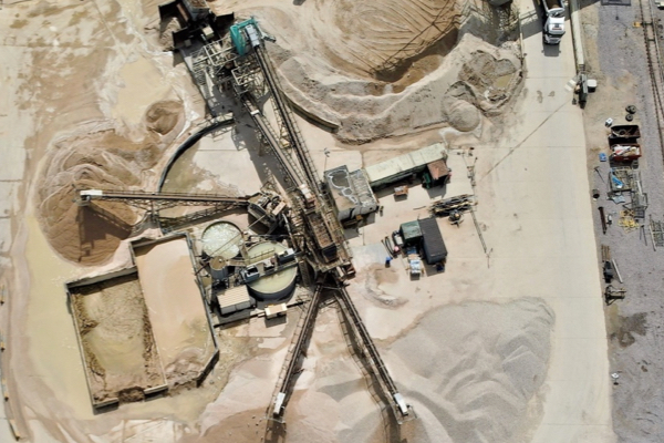
- Data from inaccessible areas
With various workflows to choose from, we can select the best sensor for the job, be it photogrammetry, laser or a combination of sensors to provide a hybrid solution.
Deliverables can be as straightforward as ortho imagery of your site, video and imagery for inspection purposes through to 3D models with defined resolutions and accuracies being offered.
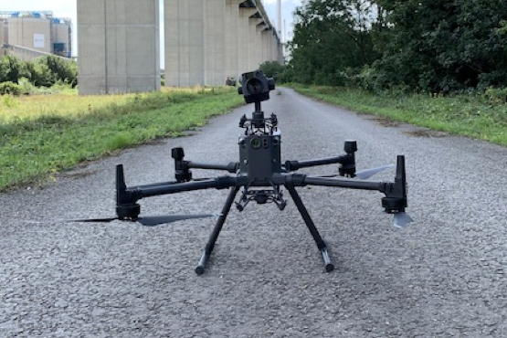
Using our DJI Matrice 300 RTK drone allows us to operate near bridges, power lines and wind turbines with positional accuracies of +/- 20mm. This allows us to capture very high quality imagery in a safe and expedient way. Our drone technology enables the acquisition of data from inaccessible areas such as rivers, quarries, ports and mountainous terrain that land based scanning systems would struggle with.
Speak to us today on
+44 (0) 1691 777 774
3 Cedar Court, Brynkinalt Business Centre, Chirk, Wrexham, LL14 5NS
Find Us
“I first saw OR3D at a MAC event at the NEC, in Birmingham, when James was holding practical demonstrations. I realised how much easier it would be for us to have our products scanned and then rendered to make 3D models as, with clients across the world, sometimes language can be a barrier. We previously used photographs to advertise our products, but these 3D images are consistent, our products look uniform, and the overall effect is informative and professional. I would certainly recommend OR3D and look forward to using their services again.”
Simon Hanmer (Managing Director of Freddy Products)